Aerial view of Wentzville Parkway exit and Highway 70 interchang…
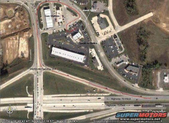
This aerial image shows a highway interchange and several commercial buildings, including a gas station and a restaurant.
Is this accurate? Sign in to help verify it.
Comments
More from this build





No comments yet.