SuperMotors SuperMotors SUPERMOTORS Search: try “orange Bronco on 35s”
Home/ Registry/ Ford/ Explorer/ 1991-1994/ “chupakabras”/ Photo supermotors.net/registry/media/490767

Satellite map showing a red dotted line route with arrows, indic…
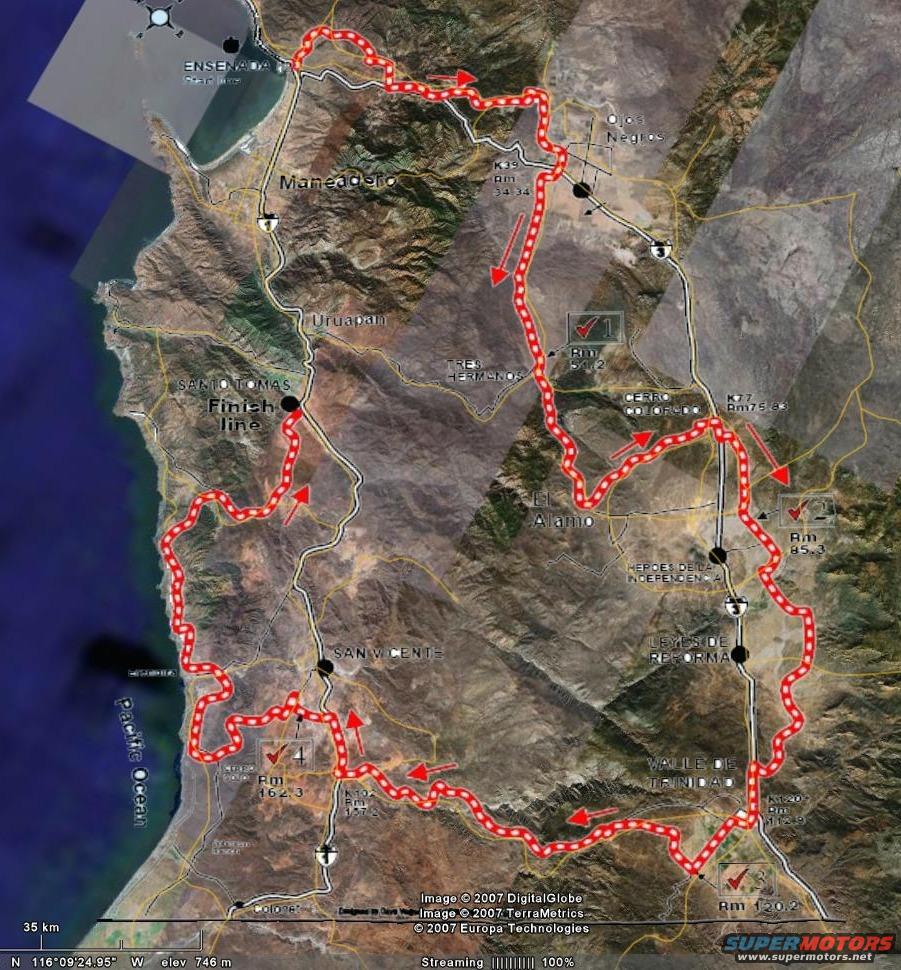
Satellite map showing a red dotted line route with arrows, indicating a race course through a desert landscape with towns like Ensenada and San Quintin labeled
Satellite map showing a red dotted line route with arrows, indicating a race course through a desert landscape with towns like Ensenada and San Quintin labeledOriginal file
Satellite map showing a red dotted line route with arrows, indicating a race course through a desert landscape with towns like Ensenada and San Quintin labeled

This is a satellite map displaying a race course route overlaid on a geographical area.

AI caption · Photo 14 of 187

Is this accurate? Sign in to help verify it.

Comments

No comments yet.

More 1991-1994 Explorers