Home/
Registry/
Ford/
Mustang/
1964-1973/
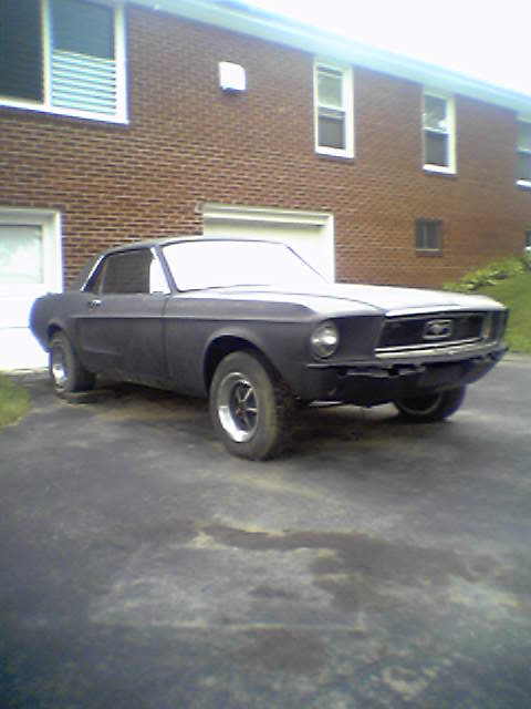
“Project Car”/
Photo
supermotors.net/registry/media/1038087
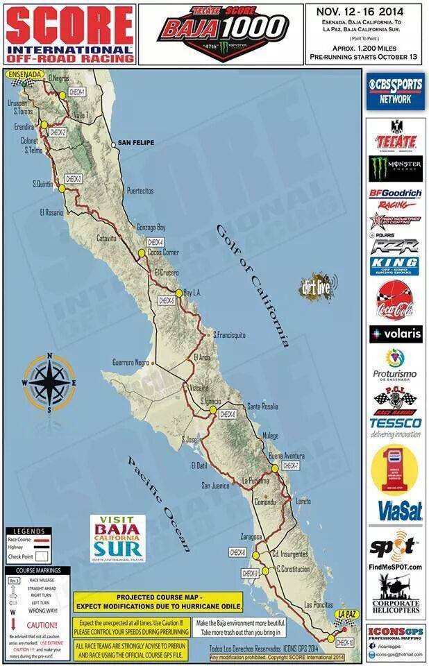
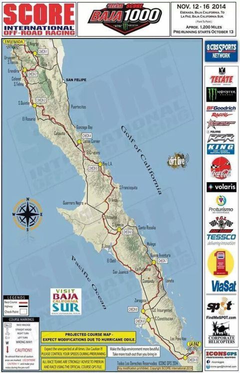
2014 Tecate SCORE Baja 1000 Course Map - Ensenada to La Paz, 47th Annual Race
Reference · 1964-1973 MustangAll 42 brochures & literature





Promotional Baja 1000 off-road race course map poster showing the route and sponsors.
Part of 1964-1973 Ford Mustang Brochures & Literature
This document is the official projected course map poster for the 47th Tecate SCORE Baja 1000, held November 12-16, 2014, running point-to-point from Ensenada, Baja California, to La Paz, Baja California Sur, approximately 1,200 miles, with pre-running starting October 13. The map depicts the Baja peninsula between the Pacific Ocean and the Gulf of California, showing the race course in red, highways in black, and ten numbered checkpoints (CHECK-1 through CHECK-10) along the route through towns including Uruapan, Colonet, San Quintin, El Rosario, Catavina, Cocos Corner, Bay L.A., Guerrero Negro, Vizcaino, San Ignacio, Santa Rosalia, Mulege, La Purisima, Loreto, Ciudad Insurgentes, Ciudad Constitucion, and La Paz. A legend explains course markings (race mileage, straight ahead, right/left turn, wrong way, caution), warning that not all caution areas are marked and racers should take notes during pre-runs. Prominent notices state the map is a projected course subject to modifications due to Hurricane Odile, urge speed control during pre-running, and strongly advise teams to prerun and race using the official course GPS file. Sponsor logos include CBS Sports Network, Tecate, Monster Energy, BFGoodrich Racing, Rigid Industries, Polaris RZR, King Shocks, Coca-Cola, Volaris, PCI Race Radios, TESSCO, ViaSat, SPOT, Corporate Helicopters, and ICONS GPS. Copyright SCORE International 2014.
Is this accurate? Sign in to help verify it.
Frequently asked questions
- When was the 2014 Baja 1000 held?
- November 12-16, 2014, with pre-running starting October 13.
- What was the 2014 Baja 1000 route and distance?
- A point-to-point course from Ensenada, Baja California, to La Paz, Baja California Sur, approximately 1,200 miles.
- How many checkpoints were on the 2014 Baja 1000 course?
- The map shows ten checkpoints, labeled CHECK-1 through CHECK-10, ending near La Paz.
- Why does the map say the course is 'projected'?
- The poster states 'PROJECTED COURSE MAP - EXPECT MODIFICATIONS DUE TO HURRICANE ODILE,' meaning changes were possible due to hurricane damage.
- What navigation guidance did SCORE give race teams?
- All race teams were strongly advised to prerun and race using the official course GPS file, control speeds during prerunning, and note that not all caution areas are marked on the course.
No comments yet.